


Description
Product Overview
The DK Children Illustrated Atlas is a meticulously crafted educational resource designed for children aged nine to twelve. Spanning 66 pages, this atlas combines vibrant, full‑color maps with concise, age‑appropriate facts that bring continents, countries, and cultures to life. Each page is printed on high‑quality paper to ensure durability for frequent handling in classrooms, libraries, and homes. The atlas covers physical geography, climate zones, major landmarks, and cultural highlights, providing a comprehensive yet accessible overview of the world. It aligns with grade levels 4 through 7, making it an ideal supplement for geography curricula and homeschooling programs. The clear typography and thoughtfully organized layout support independent reading and foster curiosity about global connections.
![[Product front view showing all components]](https://www.healthyfamily.store/wp-content/uploads/2026/06/9968f5a2ed25490ebb674b49ad383f84.jpg)
Usage
Educators can integrate this atlas into daily lessons, using it as a visual aid during discussions about continents, oceans, and ecosystems. The concise facts enable quick reference during classroom activities, while the vivid illustrations capture students’ attention and encourage deeper exploration. Homeschooling parents will find the atlas valuable for structured geography units, allowing children to progress at their own pace. The portable digital format (52.8 MB Kindle file) also makes it convenient for on‑the‑go learning during family trips, road trips, or vacations, where real‑world observations can be linked directly to the maps. Additionally, the atlas serves as a supportive tool for project‑based learning, such as creating country reports, mapping personal travel routes, or preparing presentations for school fairs.
Why Choose Us
DK Children is a trusted name in children’s publishing, known for delivering high‑quality, research‑backed content that engages young minds. This atlas benefits from DK’s rigorous editorial standards, ensuring factual accuracy and age‑appropriate language. The product’s design emphasizes readability, with clear legends, icons, and color coding that simplify complex geographic concepts. Unlike generic atlases, this edition includes curated cultural notes that celebrate diversity and promote global awareness. The digital format offers instant access without the need for physical storage, and the file size is optimized for smooth performance on Kindle devices. DK Children also provides responsive customer support, offering assistance with device compatibility, content updates, and educational resources.
Key Features
- 66 pages of vivid, full‑color maps that make world geography instantly understandable.
- Age‑appropriate facts written for readers 9‑12, aligning with grades 4‑7 curriculum standards.
- Durable digital format (52.8 MB) optimized for Kindle devices, ensuring quick loading and easy navigation.
- Clear legends, icons, and color‑coded sections that simplify learning and support visual learners.
- Dedicated DK Children customer support for technical help and educational guidance.
FAQ
What devices can I read this atlas on?
The atlas is compatible with all Kindle e‑readers, Kindle apps for iOS and Android, and other devices that support the Kindle format. It can be accessed on tablets, smartphones, and computers through the Kindle app.
Is the content suitable for classroom use?
Yes. The atlas aligns with grade 4‑7 geography standards and includes concise facts and clear maps that support lesson planning, group activities, and individual study.
Can I print any pages for offline use?
The Kindle version is designed for digital reading only and does not include a printable PDF. However, you can take screenshots of specific pages for personal reference, respecting copyright guidelines.
How often is the content updated?
DK Children periodically releases updates to ensure geographic information remains current. When an update is available, Kindle devices will prompt you to download the latest version.
What support is available if I have technical issues?
DK Children offers responsive customer service via email and live chat. They can assist with device compatibility, file download problems, and any questions about the atlas content.



 Giunti Italian Historical Fiction eBook – 362‑Page 19th Century Tale
  Hynec 2-Way Luer Lock Stopcock, 5/32" 4.0mm Multi-Purpose Valve for Lab Equipment, School Projects & DIY Experiments (20-Pack)
  Historical Fiction eBook by Marsilio Italian Kindle Edition 149 Pages
  EINAUDI Italian History Kindle eBook 182 Pages Historical Fiction
  Kimble Chase 420163-0001 One-Way Stopcock Valve, Female Luer to Male Luer Lock (Pack of 10)
  QWORK 3-Way Stopcocks Luer Connection Sterile 20 Pack Blue
  Stopcocks Tomopal Nylon with Clear PC Lock Ring Pack of 50
 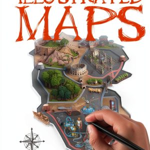 How to Draw Maps for Kids – The Salariya Book Company eBook, 33‑Page
  Nylon 1-Way Stopcocks by Tomopal Inc. 50ml Luer Fitting Pack of 50
 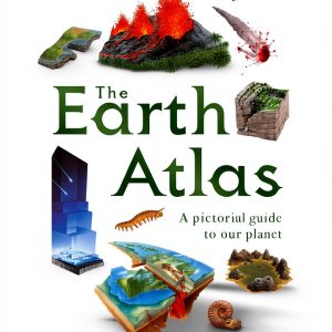 Children's Atlas by DK Children 66‑Page Illustrated World Map for 9‑12
  Lonely Planet Kids World Atlas Ages 9 12 Colorful Maps Interactive
  Historical Fiction eBook by DigiCat Italian Kindle Novel 162 Pages
Reviews
There are no reviews yet.