


Description
Product Overview
![[Product front view showing all components]](https://www.healthyfamily.store/wp-content/uploads/2026/06/07181374812041c7a645bec66527d412.jpg)
The DK Children Atlas for ages 8‑12 is a thoughtfully designed reference book that invites young explorers to discover the planet’s geography in a vivid, engaging format. Each page combines clear, age‑appropriate language with striking full‑color artwork, allowing children to grasp complex concepts such as continents, oceans, climate zones, and cultural landmarks without feeling overwhelmed. The atlas is organized by region, providing a logical flow that mirrors school curricula and supports independent study. High‑resolution photographs and hand‑drawn illustrations are paired with concise captions, ensuring that readers can quickly locate the information they need while staying captivated by the visual storytelling. By integrating educational content with an inviting layout, the book serves both as a classroom resource and a personal library favorite, encouraging curiosity and a lifelong love of learning. The durable paperback binding ensures the atlas withstands frequent handling, making it ideal for both home and school environments.
The visual design of this atlas is a hallmark of DK Children’s commitment to quality illustration. Every continent is represented by a full‑page spread that blends realistic satellite imagery with hand‑drawn maps, giving children a sense of both scientific accuracy and artistic flair. Color palettes are carefully chosen to differentiate landforms, water bodies, and political boundaries, reducing confusion for early readers. Iconic landmarks such as the Great Wall of China, the Eiffel Tower, and the Serengeti migration routes are highlighted with inset photos, providing contextual depth that sparks further inquiry. In addition, the atlas includes sidebars featuring fun facts, animal profiles, and cultural notes, all written in a tone that resonates with pre‑teens. These visual cues not only aid memory retention but also encourage children to explore related topics beyond the pages, fostering interdisciplinary learning across history, science, and art.
While the printed edition does not contain digital interactivity, the layout mimics the experience of an interactive map, guiding readers through a logical progression of discovery. Each region section begins with a simplified world map that highlights the area’s location relative to the globe, helping children develop spatial awareness. Subsequent pages zoom in to reveal detailed country outlines, major cities, and natural features, allowing learners to trace routes and compare distances. The atlas also incorporates a series of “Did you know?” callouts that prompt readers to answer questions or locate specific points on the map, turning passive reading into an active problem‑solving exercise. By encouraging children to physically point, draw, or discuss the information, the book reinforces geographic concepts and supports kinesthetic learning styles, which are especially effective for the 8‑12 age group.
The content aligns closely with national and international education standards for geography and social studies, making it a valuable supplement for teachers seeking curriculum‑compatible resources. Topics such as climate zones, population distribution, and economic activities are presented in a manner that satisfies learning objectives for upper elementary grades. Moreover, the atlas includes a teacher’s guide (available as a downloadable PDF) that offers lesson plans, activity suggestions, and assessment ideas, enabling educators to integrate the material seamlessly into classroom instruction. For homeschooling families, the clear structure and self‑contained chapters allow for flexible pacing, while the comprehensive index at the back provides quick reference for research projects. By bridging the gap between textbook rigor and engaging storytelling, the atlas supports both formal education and independent curiosity‑driven exploration.
The DK Children Atlas is published in a sturdy paperback format measuring 8.5 × 11 inches, providing ample space for detailed maps and large‑print text that is easy on young eyes. At 66 pages, the book balances depth of content with a manageable size, ensuring that readers are not overwhelmed by excessive length. The paper quality is thick enough to prevent bleed‑through from markers, encouraging children to annotate or highlight favorite sections without damaging the pages. Additionally, the book complies with accessibility guidelines, offering clear typography and high‑contrast color schemes that aid readers with visual sensitivities. For families who prefer digital options, a Kindle version is also available, featuring adjustable font sizes and a searchable index, though the printed edition remains the preferred choice for tactile learning experiences.
Usage
In a classroom setting, the atlas serves as a central reference point during geography lessons, map‑reading drills, and interdisciplinary projects. Teachers can assign small groups to explore specific regions, encouraging collaborative discussion and presentation skills as students share findings about climate, culture, and landmarks. The clear layout allows for quick lookup during spontaneous questions, keeping the flow of instruction smooth and engaging. By integrating the atlas into daily routines, educators reinforce spatial vocabulary and critical thinking, while also providing a visual anchor that supports diverse learning styles.
For homeschooling families, the atlas offers a flexible curriculum tool that can be adapted to various pacing schedules. Parents can design weekly modules focusing on a continent, using the book’s sidebars and fact boxes to create quizzes, creative writing prompts, or art projects. The inclusion of “Did you know?” challenges encourages independent problem‑solving, allowing children to test their knowledge without constant adult supervision. Because the atlas is self‑contained, it eliminates the need for multiple supplemental texts, simplifying resource management while still delivering comprehensive geographic education.
Beyond formal education, the atlas is an excellent companion for family trips and travel planning. When preparing for a vacation, children can locate their destination on the world map, identify nearby countries, and learn about local customs before departure. During the journey, the book can be consulted at hotel rooms or on road trips, turning idle time into an informative adventure. The durable binding and compact size make it easy to pack, while the engaging visuals keep young travelers curious and entertained, turning every stop into a learning opportunity.
Why Choose Us
DK Children has built a global reputation for producing high‑quality educational books that combine rigorous research with captivating design. Each atlas undergoes a meticulous editorial process involving subject‑matter experts, cartographers, and child psychologists to ensure accuracy, relevance, and age‑appropriate presentation. The brand’s commitment to continuous improvement means that new editions are regularly updated with the latest geographic data, reflecting changes in political boundaries, population trends, and environmental information. Parents and educators trust DK’s name as a guarantee of reliable, engaging content that stands the test of time.
The development of this atlas began with extensive classroom observations and focus groups with children aged 8‑12, allowing the design team to identify the most effective ways to convey complex geographic concepts. Researchers mapped out learning pathways that align with cognitive development stages, ensuring that each page builds upon prior knowledge without causing overload. Illustrators collaborated closely with cartographers to produce maps that are both scientifically accurate and visually appealing, while writers crafted concise explanations that avoid jargon. This evidence‑based approach results in a product that not only educates but also inspires curiosity, making learning a natural and enjoyable process.
DK Children stands behind its products with a dedicated customer support team ready to assist educators, parents, and students. Buyers can access a comprehensive online help center that includes downloadable teacher guides, activity sheets, and troubleshooting tips for both print and digital formats. If any issues arise, such as missing pages or printing defects, the company offers a hassle‑free replacement policy within 30 days of purchase. Additionally, the brand maintains an active community forum where users share lesson ideas, classroom experiences, and creative ways to integrate the atlas into curricula, fostering a collaborative environment that extends the value of the book beyond its pages.
Key Features
- Vivid full‑color maps that combine satellite imagery with hand‑drawn illustrations, helping children visualize geography clearly. Each region includes labeled borders, major cities, and key natural features to reinforce learning.
- Age‑appropriate text written in an engaging tone, offering concise explanations and fun facts that match the reading level of 8‑12 year olds. The language avoids jargon while still introducing essential geographic terminology, building confidence and vocabulary.
- Logical regional organization that mirrors school curricula, allowing teachers to align lessons with standards and students to progress through continents in a structured sequence. Each chapter includes review questions that reinforce key concepts and promote retention.
- Durable paperback construction with thick, bleed‑through resistant pages, encouraging young readers to annotate, highlight, and interact with the material without damaging the book. The sturdy binding withstands frequent handling in classroom and home environments, ensuring longevity.
- Comprehensive teacher support, including downloadable lesson plans, activity sheets, and a 30‑day replacement guarantee, providing educators with resources and peace of mind. Customer service is available for any queries, ensuring a smooth experience for schools and families alike.
FAQ
What age range is this atlas suitable for?
The atlas is specifically written for children aged 8 to 12, which corresponds to grades 3 through 7 in most school systems. The language, illustrations, and level of detail have been calibrated to match the cognitive and reading abilities of this age group. Younger children may still enjoy the colorful maps with adult guidance, while older pre‑teens can use the book for more in‑depth projects and research. Because the content aligns with standard geography curricula, it serves both as an introductory resource for beginners and a reference guide for more advanced learners within the same age bracket.
Can the atlas be used alongside digital resources?
Yes, the printed atlas complements digital learning tools. While the book itself does not contain interactive features, educators can pair its maps with online globes, GIS applications, or classroom smart‑board activities to reinforce concepts. The Kindle version offers searchable text and adjustable font sizes, which can be useful for students who prefer electronic reading. However, many teachers find that the tactile experience of flipping pages and physically pointing to locations enhances spatial awareness and retention. By integrating both print and digital formats, schools can cater to diverse learning preferences and maximize engagement.
What support does DK Children provide if I have questions about the product?
DK Children offers a dedicated customer support team reachable via email or phone, ready to address any concerns about the atlas. Buyers can access an online help center that includes FAQs, downloadable teacher guides, and printable activity sheets. If the book arrives damaged or missing pages, the company provides a free replacement within 30 days of purchase. Additionally, the brand maintains an active community forum where educators share lesson ideas and troubleshooting tips. This comprehensive support network ensures that both teachers and parents receive the assistance they need to get the most out of the product.
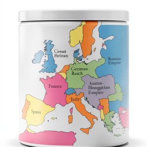






 Pennsylvania Kids Travel Guide Interactive Kindle Atlas by Amazon
  Radiology Adhesive Marker RADHESIVE Pink PVC Chisel XMHG0721 3x3in
  Historical Fiction eBook Giunti Italian Kindle Edition 528‑Page Novel
  Le lupe di Pompei Kindle Book by Fazi Editore Historical Fiction
  World Atlas for Kids Print Replica eBook by Amazon Age 10-18 1.7 MB
  Historical Fiction eBook EINAUDI Italian Kindle Enhanced Typesetting
  25 packs: Flow Regulator I.V. Set(20DP/ML Luer Lock) with 3-way STOPCOCK, Clear
  Rizzoli Historical Fiction Kindle eBook Italian Edition 212 Pages
  Baby Professor Kids World Atlas – 64‑Page Kindle Edition for K‑12
  Historical Fiction eBook – Newton Compton Editori Kindle Edition
  QWORK 3-Way Stopcocks Luer Connection Injection Stopcock 20 Pack
  2-Way Stopcock with Luer Connection, Female Luer Ends, PP Material, 100-Pack
  Two Way Stopcock Homaisson Luer Lock 15pcs Blue Handle with Lock Cap
  Hynec 2-Way Luer Lock Stopcock 4.0mm EO Sterilized Valve 20 Pack
  Nylon 1-Way Stopcocks by Tomopal Inc. 50ml Luer Fitting Pack of 50
Reviews
There are no reviews yet.