


Description
Product Overview
Discover a world of learning with the Children’s Atlas from duopress, a Kindle eBook crafted specifically for curious minds aged two years and older. This digital atlas spans sixteen richly illustrated pages, each designed to capture the imagination of early learners while providing accurate geographic information. The eBook leverages Kindle’s guided view technology, allowing children to effortlessly navigate from one continent to the next with a simple swipe. The layout is optimized for both portrait and landscape orientations, ensuring a seamless reading experience on any Kindle device or compatible tablet. The content is presented in clear, age‑appropriate language, making complex concepts like oceans, mountain ranges, and cultural landmarks accessible to young readers. File size remains modest at 8.9 MB, guaranteeing quick downloads and smooth performance even on devices with limited storage.
![[Product front view showing all components]](https://www.healthyfamily.store/wp-content/uploads/2026/06/f577cc7ccb564852a7e944e98821fd3f.jpg)
Usage
Designed for flexibility, this atlas fits naturally into a variety of daily routines. Parents can incorporate it into bedtime stories, allowing children to explore a new region each night. Teachers can use the eBook as a supplemental resource during geography lessons, projecting pages onto a classroom screen for group discussion. The guided view feature encourages independent exploration, so children can select the continent they are most interested in without assistance. The lightweight digital format makes it ideal for travel; whether on a family road trip or a flight, the atlas provides an engaging, screen‑friendly activity that reduces the need for physical books. Its interactive nature also supports screen‑time balance, as the guided view limits scrolling to intentional page turns, fostering focused learning sessions.
Why Choose Us
duopress has a long‑standing reputation for producing educational content that blends rigorous standards with captivating visuals. This Children’s Atlas continues that tradition by combining high‑resolution artwork with a user‑friendly digital interface. Each illustration is hand‑drawn and digitally enhanced to ensure clarity on all screen sizes. The eBook undergoes thorough editorial review to guarantee factual accuracy, making it a trustworthy resource for parents and educators alike. Additionally, duopress offers responsive customer support; any questions about device compatibility or usage are addressed promptly through their dedicated help center. The product also benefits from Kindle’s robust ecosystem, including automatic updates, secure cloud storage, and the ability to sync progress across multiple devices.
Key Features
- Vivid, child‑friendly illustrations that bring continents to life
- Guided view navigation for effortless, swipe‑based exploration
- Age‑appropriate language that simplifies complex geographic concepts
- Compact 16‑page format perfect for short attention spans and travel
- Responsive customer support and regular content updates from duopress
FAQ
Is this eBook compatible with all Kindle devices?
Yes, the Children’s Atlas works on any Kindle device that supports guided view, as well as on the Kindle app for iOS and Android tablets.
Can I print any of the pages for offline use?
The eBook is designed for digital consumption only; printing is not supported to preserve the interactive experience and copyright protections.
What age range is this atlas best suited for?
The content is tailored for children two years and older, making it ideal for preschoolers, early elementary students, and families seeking introductory geography material.
Does the atlas include audio narration?
No, the current version focuses on visual and textual learning. Future updates may introduce optional narration based on user feedback.
How often is the content updated?
duopress releases updates as needed to keep geographic information current. Users receive updates automatically through the Kindle platform.








 Kids World Atlas Kindle Edition by Amazon with 140 Page Map Book
  Kids Earth Atlas by Phillips Kindle Edition for Ages 11 to 14
  Lonely Planet Kids World Atlas Ages 9 12 Colorful Maps Interactive
  Saga della Serenella Book 1 - Italian Kindle Fiction Navicelli
  Children's Atlas by Tordwifel Books Kindle eBook 912 Page Map
  Children's Atlas Kindle eBook by Amazon - 16 Page Map for Ages 8-18
  Spanish Children Atlas Nórdica Libros Kindle eBook 244‑Page Map
  Children's Atlas by DK Children 66‑Page Illustrated World Map for 9‑12
 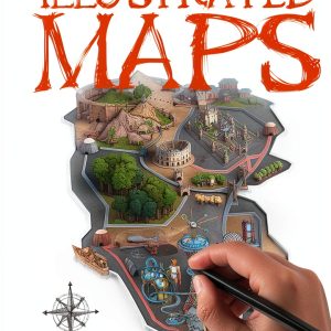 How to Draw Maps for Kids – The Salariya Book Company eBook, 33‑Page
  Historical Fiction eBook EINAUDI Italian Kindle Enhanced Typesetting
  Pennsylvania Kids Travel Guide Interactive Kindle Atlas by Amazon
  Mussolini Historical Fiction Kindle eBook by Bompiani – Italian Novel
  Kingsbridge Historical Thriller Kindle eBook by MONDADORI – Italian
  Children's Atlas duopress Kindle eBook Ages 2+ Guided View 16 Pages
  Historical Fiction eBook by Marsilio Italian Kindle Edition 149 Pages
  Kids World Atlas by DK Children Interactive Maps for Ages 6 to 10
  BBC Children Atlas Interactive World Map for Ages 8 to 17
  World Atlas for Kids Print Replica eBook by Amazon Age 10-18 1.7 MB
  DK Children Kids Atlas for Grades 4-7 66 Page Illustrated Geography
  Historical Fiction eBook by Tre60 – 421‑Page Italian Kindle Novel
Reviews
There are no reviews yet.