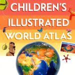


Description
Product Overview
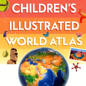
The DK Children Kids Atlas is a meticulously designed educational resource that brings the vastness of our planet into the hands of young explorers. Spanning 66 pages, this atlas combines vibrant, full‑color maps with concise, age‑appropriate text to create an engaging learning experience for children aged nine to twelve. Each continent is presented with clear boundaries, major cities, and notable physical features, allowing readers to develop a solid geographic foundation while enjoying the visual appeal of detailed illustrations. The book’s layout follows a logical progression, beginning with an introduction to map reading skills, moving through regional overviews, and concluding with fun facts that inspire curiosity about cultures, wildlife, and global landmarks. Printed on high‑quality paper, the pages are durable enough to withstand frequent handling in classroom settings or at home.
![[Product front view showing all components]](https://www.healthyfamily.store/wp-content/uploads/2026/06/00d505ce06eb478490d630877210830f.jpg)
Usage
This atlas is perfectly suited for a variety of educational contexts. In the classroom, teachers can integrate the atlas into geography lessons, social studies projects, and interdisciplinary activities that connect history, science, and language arts. The clear visuals support visual learners, while the concise explanations cater to readers who prefer straightforward information. At home, parents can use the atlas as a tool for bedtime reading, encouraging children to ask questions about distant lands and fostering discussions about travel, diversity, and environmental stewardship. The book also serves as an excellent companion for field trips, allowing students to reference maps before, during, and after visits to museums, zoos, or local landmarks. Its portable size makes it easy for young readers to carry it in a backpack, ensuring that learning can happen anywhere, from the school library to a family road trip.
Why Choose Us
Choosing the DK Children Kids Atlas means selecting a product backed by a reputable publisher known for delivering high‑quality educational content. DK Children has a long history of producing visually rich books that combine accuracy with accessibility, and this atlas is no exception. Every map has been carefully vetted by geography experts to ensure factual correctness, while the illustrations have been crafted by skilled artists who understand how to capture the imagination of young readers. The atlas also aligns with common core standards for geography education, making it a reliable resource for teachers seeking curriculum‑aligned materials. Additionally, the book includes a glossary of key terms, helping students build a robust vocabulary related to cartography, climate, and cultural studies. Our commitment to customer satisfaction extends beyond the product itself; we offer responsive support for educators and parents who have questions about integrating the atlas into their teaching plans.
Key Features
- Vivid, full‑color maps that make complex geographic concepts easy to understand for children.
- Age‑appropriate language and concise explanations that keep young readers engaged without overwhelming them.
- Durable paper and binding designed to survive frequent classroom use and enthusiastic handling.
- Curriculum‑aligned content that supports common core geography standards and classroom activities.
- Responsive customer support and resources for teachers and parents to maximize the book’s educational impact.
FAQ
What age group is this atlas best for?
The atlas is specifically written for children aged nine to twelve, which corresponds to grades four through seven. The language, map detail, and activities are tailored to match the developmental and academic needs of this age range.
Does the atlas include a glossary of geographic terms?
Yes, at the end of the book you will find a glossary that defines key geographic vocabulary such as “latitude,” “equator,” and “archipelago,” helping students reinforce their learning and expand their terminology.
Can the atlas be used for both classroom and home learning?
Absolutely. The design of the atlas makes it versatile for structured classroom lessons, group projects, and independent study at home. Its portable size and durable construction support a wide range of learning environments.
Is the content aligned with educational standards?
Yes, the atlas aligns with common core standards for geography and social studies, ensuring that it complements existing curricula and helps teachers meet required learning objectives.
What kind of support is available if I have questions about using the atlas?
DK Children provides dedicated customer support for educators and parents. You can reach out via email or phone for assistance with lesson planning, activity ideas, or any product‑related inquiries.

 Luer Stopcocks 3 Way TODA Fluid Control Injection Stopcock 100 Pack
  Historical Fiction eBook by Marsilio Italian Kindle Edition 149 Pages
  Azlon 505634-7 Replacement Stopcock for Carboy – Heavy Duty Leak‑Proof
  Two Way Stopcock Homaisson Luer Lock 15pcs Blue Handle with Lock Cap
Reviews
There are no reviews yet.